Friday, September 25, 2026

Bellevue – 55–57 Leichhardt Street – Glebe Point – NSW

Bellevue – 55–57 Leichhardt Street – Glebe Point – NSW

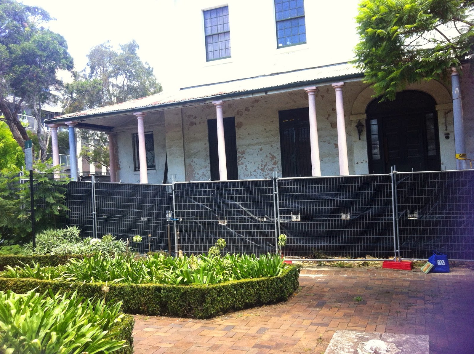
Victorian Italianate villa on Jarrett’s Point · Ambrose Thornley Junior 1896 · Saved 1970s · Standing — City of Sydney / Blackwattle Bay Park · NSW SHR #00470

Bellevue is the little Italianate villa that clung to Blackwattle Bay when Venetia fell and the timber yards came. Glebe activists stopped illegal demolition in the mid-1970s; Council and then the City of Sydney restored it for the foreshore park. It is not Bellevue Hill, and it is not the vanished Venetia behind it.

At a glance

  • Address: 55–57 Leichhardt Street, Glebe / Glebe Point NSW 2037
  • Other names on SHR: site of former Venetia (demolished); 55 Leichhardt Street
  • Traditional Custodians: Wangal / Cadigal of the Eora Nation (SHR / Barani framing)
  • Built: c.1896 for William Jarrett; architect Ambrose Thornley Junior (SHR). Soft: DoS / some local walks 1883
  • Style: restrained late Victorian Italianate; stuccoed brick; bullnose verandah; plaster eaves brackets (SHR)
  • Point name: Jarrett’s Point between Blackwattle Bay and Rozelle Bay
  • Adjoining story: larger Venetia (c.1875) demolished c.1914–15 after Windeyer purchase; high archaeological potential (SHR)
  • Heritage: NSW SHR #00470 (2 Apr 1999); PCO 25 Jul 1986; National Trust; City of Sydney LEP
  • Fate: Standing — City of Sydney ownership; Blackwattle Bay Park setting; café / community chapters (verify operator)

Site & setting

Foreshore headland once lined with marine villas, then Vanderfield & Reid timber yards, then landfill park. Bellevue is a landmark in Blackwattle Bay Park — highly visible from bay and foreshore walk (SHR aesthetic criteria). Venetia’s footprint lies under later fill beside/behind; treat as archaeology, not standing fabric.

Timeline

  • 1789+ — Johnson Glebe grant; 1828 Church subdivisions; Spark then Chisholm chapters (SHR).
  • 1873 – William Jarrett buys lots on the point; c.1875 builds Venetia (SHR).
  • 1876 – Jarrett acquires Bellevue’s lot 47 from Ambrose Thornley Senior (SHR).
  • 1896 – Bellevue built to Ambrose Thornley Junior’s design — reputed for a Jarrett daughter; early tenants Ewin Cecilia then J.G. Warden (SHR / Glebe Society).
  • 1901 – Jarrett dies; Jul 1913 – Bellevue & Venetia sold to William Archibold Windeyer.
  • c.1914–15 – Venetia demolished (SHR).
  • From c.1925 – Bellevue ceases house use; timber milling across the point (SHR).
  • 1970s – Parkes Developments threat; community / Glebe Society stop demolition; park deal; fill dumped; Section 130 Order 16 May 1980 (SHR).
  • End 1981 – Leichhardt Council purchases foreshore including Bellevue; Blackwattle Bay Park opens Aug 1983.
  • 1986 – PCO; re-roofing grant; 1999 – SHR.
  • 2003 – Transfers to City of Sydney; 2005–07 CMP / restoration; 3 Mar 2007 open day (SHR).
  • 2011+ – Café chapters intermittent (SHR / press) — verify at publish.
  • Today – Restored villa in public park; social significance of the 1970s save remains central (SHR).

Architecture & interiors

Part two-storey stucco Italianate cottage with bullnose verandah and plaster eaves brackets (SHR). Inventory notes comprehensive earlier loss of joinery/ornament during dereliction, then City restoration (tessellated tiling, slate roof, plaster cornices cited on Glebe Walks). Prefer CMP / post-2007 fabric notes over inventing 1896 interiors.

People & anecdotes

William Jarrett — publican, building-society manager, Glebe alderman, developer of the point (SHR / Glebe Society). Ambrose Thornley Junior — local architect (Glebe Town Hall among works); bankrupt in 1890s depression (SHR). Windeyer — solicitor purchaser 1913. Glebe Society / local activists — 1970s save. Soft cultural note: Australian Crawl “Beautiful People” video filmed at dilapidated Bellevue 1979 (Wikipedia — secondary).

Image gallery guidance

1. 1899 Hall photograph — Bellevue with Venetia behind (SLNSW / live Venetia post gold).

2. Dilapidated 1970s state vs 2007 restoration open day.

3. Blackwattle Bay Park / foreshore walk context.

4. Bay elevation landmark shots.

5. Caption Venetia carefully as demolished.

What stands today

Bellevue stands in Blackwattle Bay Park under City of Sydney custodianship and State Heritage listing. Exterior and park setting are the public experience; café tenancy status changes — check before advertising hours. Pair with the Venetia–Bellevue sister scrapbook for the demolished twin.

Sources & further reading

Related on this blog

  • Venetia (demolished) & Bellevue sister scrapbook — keep names straight
  • Toxteth Park, Glebe
  • Lyndhurst, Glebe — Verge marine villa (cross-link Lyndhurst draft)
  • Bidura, Glebe — Glebe Point Road villa (cross-link Bidura draft)
  • Tranby / Reussdale — this batch Glebe cluster

Add historic photos with captions and credits (SLNSW / Trove / author) from Image gallery guidance.

Reussdale – 160 Bridge Road – Glebe – NSW

Reussdale – 160 Bridge Road – Glebe – NSW

Picturesque Gothic / High Victorian villa · Ferdinand Reuss c.1868–70 · Former Presbyterian manse · Standing — private · NSW SHR #00292

Ferdinand Reuss stacked apricot brick, a pointed bay and a tower on Bridge Road — possibly Glebe’s earliest High Victorian domestic design. Reussdale sat in his speculative row with The Hermitage, Hamilton and Alma Villa; the Presbyterians later made it a manse beside a church hauled stone-by-stone from Broadway. Dereliction followed; State listing and twenty-first-century works brought the villa back.

At a glance

  • Address: 160 Bridge Road, Glebe NSW 2037
  • Other name: former Presbyterian Manse
  • Traditional Custodians: Wangal / Cadigal of Eora Country (SHR district framing)
  • Built: c.1868–1870 (SHR); by 1871 / Collingwood “completed by 1868”
  • Architect/builder: Ferdinand Reuss (1821–1896)
  • Style: Victorian Picturesque Gothic marrying Italianate influences; exposed apricot-brown brick speckled with crushed coal; triangular pointed bay unique in Glebe (SHR / Smith)
  • Group: Reuss Bridge Road row — The Hermitage 154 (Reuss home 1866–96), Hamilton 156, Alma Villa 158 (demolished 1927 for church), Reussdale 160; also attributed work at 177 (Glebe Society)
  • Heritage: NSW SHR #00292 (2 Apr 1999); PCO 18 Jan 1985; RNE 1660 (21 Oct 1980); City of Sydney / former Leichhardt LEP
  • Fate: Standing — restored private residential use after long vacancy (verify at publish)

Site & setting

Southern side of Bridge Road between Glebe Point Road and Ross Street — deep setbacks, mature trees, stone front fence (SHR). Adjacent The Abbey (former Presbyterian church, relocated 1927–28 from Parramatta Rd / Glebe Point Rd corner — Glebe Society / SHR). Do not confuse with Annandale’s Johnston Street Abbey.

Timeline

  • c.1865 – Reuss buys Bridge Road parcels; builds speculative cottages (SHR / Glebe Society).
  • 1866–96 – Reuss lives at The Hermitage, 154 Bridge Road (Glebe Society / SHR).
  • c.1868–71 – Reussdale built; early occupancy by daughter Adeline Burgess & Edward Roland Halloran (Collingwood via SHR).
  • 1877 – Advertised for rental — “not be let to people with small children” (Collingwood via SHR).
  • 1896 – Reuss dies at The Hermitage; estate later passes (except Hermitage) to Presbyterian Church after 1925 (SHR).
  • 1927–28 – Alma Villa demolished; church re-erected at 158; Reussdale becomes manse; Hamilton adapted as hall/school (SHR).
  • To 1965 – Manse use (Glebe Walks); then long dereliction / fire & vandalism (SHR).
  • 1985 – PCO; 1999 – SHR.
  • 1996 – Temporary corrugated roof / bargeboards (SHR); 2014–15 – Welsh slate reinstated; residential repairs (SHR history).
  • Today – Standing private house in the Bridge Road Gothic group.

Architecture & interiors

Asymmetrical two-storey villa with tower in the re-entrant angle above the entrance (Smith via SHR). Front: exposed apricot brick; pointed triangular bay; carved sandstone lintels simulating segmental arches; wooden verandah posts with fretted brackets; elaborate gables; glass-brick diagonal pattern in tower eaves (SHR). Sides/rear historically rendered. Prefer Smith / Perumal Murphy / GML CMP descriptions; flag decades of water damage and later repairs.

People & anecdotes

Ferdinand Hamilton Reuss — London-born, Stevenson-trained civil engineer; gold-rush migrant; Sydney architect-builder-surveyor; Cleveland Paddocks / Waterloo / Balmain speculation (SHR / Glebe Society). Adeline Burgess Halloran — early resident daughter. Edward Roland Halloran — later Reuss partner; Record Reign Hall (Collingwood via SHR). Presbyterian trustees — manse chapter. De Carlo purchase tradition 1977 noted on SHR for Abbey site works — keep property narratives distinct where sources allow.

Image gallery guidance

1. Bridge Road front — apricot brick, bay, tower.

2. Group shot with relocated church (The Abbey) and Hermitage 154.

3. Historic derelict-state photos vs post-2015 slate roof.

4. Mature nettle trees / camphor / palms cited on SHR tree list (landscape context).

5. Caption Glebe Abbey ≠ Annandale Abbey.

What stands today

Reussdale stands as a State Heritage–listed private house. Streetscape appreciation from Bridge Road; interiors private. Cross-link Annandale The Abbey only to warn against name confusion.

Sources & further reading

Related on this blog

  • Toxteth Park, Glebe
  • Bidura / Lyndhurst / Bellevue / Tranby — Glebe cluster (this batch + drafts)
  • The Abbey, Annandale — different building; name collision warning (cross-link The Abbey draft)

Add historic photos with captions and credits (SLNSW / Trove / author) from Image gallery guidance.

Tranby (Toxteth Cottage) – 13 Mansfield Street – Glebe – NSW

Tranby (Toxteth Cottage) – 13 Mansfield Street – Glebe – NSW

Post-Regency estate cottage · Allen / Boyce chapters · Tranby Aboriginal Co-operative education campus from 1957–58 · Standing — Co-operative for Aborigines Ltd · NSW SHR #00021

The first house after Toxteth Park on George Allen’s estate became, a century later, Australia’s pioneering independent Aboriginal-controlled adult education centre. Stone cottage, asymmetrical plan, activism meetings, circular learning buildings at the rear — Tranby is Glebe heritage with living Indigenous significance.

At a glance

  • Address: 13 Mansfield Street (cnr Boyce Street), Glebe NSW 2037
  • Other name: Toxteth Cottage
  • Traditional Custodians: Cadigal / Wangal — Eora Country (SHR)
  • Built: listed Sands 1858 / SHR 1858; possibly as early as 1840 (Glebe Society / Collingwood via SHR)
  • Designers: A.L. & G. McCredie (SHR designer field); northern extension feasibly George Allen Mansfield (SHR notes)
  • Style: post-Regency picturesque / Georgian-character stone cottage; asymmetrical plan — among earliest in Glebe (SHR)
  • Estate: first house on Toxteth Park Estate after Toxteth House (SHR)
  • Indigenous campus: 1957 training centre under ABM Christian Community Co-operative (Alf Clint / Rev. John Hope gift); 1958 Tranby Co-operative for Aborigines; owner Co-operative for Aborigines Ltd
  • Heritage: NSW SHR #00021 (2 Apr 1999); PCO 14 Dec 1979; Register of the National Estate 21 Mar 1978
  • Fate: Standing — Aboriginal-run adult education / community facility; 1990s circular rear campus (Cracknell & Lonergan / Merrima)

Site & setting

Mansfield and Boyce Streets — both named after cottage inhabitants (SHR criteria). Small front garden; large rear garden infilled with 1990s college wing and courtyard (Stuart Read note on SHR). Toxteth Park Estate context — pair with Toxteth Park house (now St Scholastica’s). Cadigal Country with later Aboriginal migration to inner-city suburbs noted on SHR / Barani framing.

Timeline

  • 1828+ — Glebe Church subdivisions; George Allen acquires Toxteth Park lands; Verge builds Toxteth House (SHR / sister Toxteth draft).
  • c.1840–1858 — Stone cottage built in estate grounds; Sands 1858 as Toxteth Cottage (SHR / Glebe Society early-date soft).
  • By 1857–61 — Residence of Mary (Allen) & architect George Allen Mansfield; children born here (SHR).
  • 1870s — Renamed Tranby under Jane Elizabeth (Allen) & Rev. William Binnington Boyce after return from London 1877 (SHR / Glebe Society).
  • 1880s — Northern wing; 1910 — eastern wing for William Boyce Allen’s large family (SHR).
  • 1931 — University of Sydney hostel phase; Boyce Allen family until 1946 (SHR).
  • 1946 — Purchased via Rev. John Hope / ABM trusteeship chapters (SHR notes both Hope home and ABM purchase traditions).
  • 1957 — Gifted for Alf Clint’s co-operative training centre; 1958 Co-operative founded (SHR).
  • 1971 — Name registered Tranby Co-operative for Aborigines Ltd (SHR).
  • 1979 — Permanent Conservation Order; 1999 — SHR.
  • 1980s–90s — Course expansion; 1994–98 circular rear buildings (Cracknell & Lonergan; Merrima Design Unit) despite Council opposition (SHR).
  • 1998+ — National accreditation of diplomas; Jack Beetson executive director chapter (SHR).
  • 2015 — Rebrand Tranby National Indigenous Adult Education and Training (SHR).
  • Today — Continuing Aboriginal-controlled education campus; heritage cottage + contemporary rear.

Architecture & interiors

Slate-hipped stone / rendered cottage of originally six rooms; verandah on cast-iron columns; French doors; later parapet wing with Italianate flavour (SHR physical description). Bernard & Kate Smith praised low colonial lines and broad proportions (via SHR). Rear: circular masonry rooms with copper roofs — learning-circle philosophy (SHR). Do not invent lost Allen-era joinery.

People & anecdotes

George Allen — solicitor, Mayor of Sydney, Toxteth Park. George Allen Mansfield — architect son-in-law. Rev. William Binnington Boyce — Wesleyan missionary/philologist; naming. Rev. John Hope / Brother Alf Clint — ABM co-operatives; founding gift. Kevin Cook — student then General Secretary from 1981 (SHR). Meetings linked to the push for the Royal Commission into Aboriginal Deaths in Custody (SHR social criteria). Affiliate organisations historically include Blackbooks and related community units (SCC via SHR).

Image gallery guidance

1. Mansfield Street cottage elevation.

2. Historic Toxteth Estate context maps.

3. 1990s circular campus / courtyard.

4. Boyce / Mansfield street-name plaques if present.

5. Respect ongoing education use — no disruptive photography of classes.

What stands today

Tranby stands as SHR-listed cottage plus contemporary education campus, owned and run by the Aboriginal co-operative. It is a working college, not a house museum — visit/contact via Tranby’s public channels. Pair with Toxteth Park for the Allen estate story.

Sources & further reading

Related on this blog

  • Toxteth Park, Glebe — parent estate
  • Bidura / Lyndhurst — Glebe villa peers (cross-link drafts)
  • Bellevue / Reussdale — this batch Glebe cluster
  • Yasmar, Haberfield — another welfare/education-adapted villa comparison (different story)

Add historic photos with captions and credits (SLNSW / Trove / author) from Image gallery guidance.

Highroyd – 262 Johnston Street – Annandale – NSW

Highroyd – 262 Johnston Street – Annandale – NSW

Victorian Rustic Gothic “Witches’ House” · John Young late 1880s · Pair with Hockingdon · Standing — private · Leichhardt LEP I61 (local)

Highroyd and Hockingdon are the side-spired twins John Young built as income houses for daughters Annie and Nellie. Flats, enclosed verandahs and a twentieth-century squeeze came and went; decades of conservation put lace and open balconies back on the Johnston Street skyline.

At a glance

  • Address: 262 Johnston Street, Annandale NSW 2038
  • Pair: Hockingdon, 264 Johnston Street
  • Early name: Melba (Sands 1890) → Highroyd by 1900 (Heritage NSW)
  • Traditional Custodians: Wangal / Inner West corridor (acknowledge)
  • Built: c.1886–1889 (Heritage NSW); localnotes 1888–1890 (flag)
  • Builder: John Young; designer attributed John William Richards and Young (Heritage NSW)
  • Style: late Victorian gentleman’s villa / Rustic Gothic Revival features — side tower with metal-clad spire and gargoyles; steep gables; open verandahs with cast-iron lace (Heritage NSW)
  • Purpose: speculative income house for Young’s daughters Annie and Nellie (they did not reside there)
  • Technology: early reinforced concrete footings/floors in Young’s Annandale group (H.C. Kent 1924 tradition via Heritage NSW)
  • Heritage: Leichhardt LEP 2013 I61 / Heritage NSW DB 1940063 (local)
  • Fate: Standing — private residence after multi-letting phase and long restoration

Site & setting

Western high side of Johnston Street behind the continuous sandstone wall, palisade, arched gate and stone stair shared with the Abbey group (Heritage NSW). Landmark silhouette with Hockingdon; city/Anzac Bridge views noted in modern sale descriptions (secondary). Group: Kenilworth 260, Highroyd 262, Hockingdon 264, Greba 266, Oybin 270, The Abbey 272; Claremont & Rozelle demolished.

Timeline

  • 1799 – Johnston grant; 1877–78 – Young consolidates North Annandale (Heritage NSW).
  • Early 1880s – Young reacquires high-side lots south of Weynton Street (Heritage NSW).
  • c.1886–90 – Highroyd / Hockingdon built (flag date window).
  • 1890 – Sydney Water plan; Sands lists Melba (PB Black) (Heritage NSW).
  • By 1900 – Listed as Highroyd (Heritage NSW).
  • From 1920s – Multiple lettings; front verandahs enclosed (Heritage NSW).
  • Late 1980s–2000s – Owners restore; 2006–09 verandahs/lace reinstated (Heritage NSW approvals).
  • Today – Private local-heritage dwelling in the Witches’ Precinct.

Architecture & interiors

Three storeys over basement; rendered brick and concrete; steep slate gables with scalloped bargeboards; NE corner tower with metal spire and four gargoyles; front double gable into third-floor balcony; cast-iron verandahs; long southern stair window with leadlight (Heritage NSW — retain per recommendations). Matching form to Hockingdon 264 (side spires vs Kenilworth’s centre spire). Prefer Heritage NSW / DCP controls over inventing interior schedules; modern rear garage/carport noted on inventory.

People & anecdotes

John Young — “eminent Australian builder,” Mayor of Sydney / Leichhardt, Annandale promoter, mason, builder of The Abbey (ADB / Heritage NSW). Annie & Nellie Young — intended beneficiaries of the pair. John William Richards — attributed architect (also Annandale Council Chambers). H.C. Kent — 1924 account of Young’s reinforced-concrete methods (via Heritage NSW). Annandale Association — 1960s–70s advocacy that helped save the group (Heritage NSW social criteria).

Image gallery guidance

1. Pair elevations with Hockingdon 264.

2. Spire / gargoyle detail from public realm.

3. 1952 row view Kenilworth–Greba (localnotes).

4. Sandstone wall / arched gate / stone stair.

5. Pre- vs post-verandah-reinstatement photos if rights clear.

What stands today

Highroyd stands at 262 Johnston Street as a private residence within Inner West / former Leichhardt local heritage listing. Street viewing of the elevated façade and shared stone wall is the public experience; interiors are not a museum. Pair always with Hockingdon.

Sources & further reading

Related on this blog

Add historic photos with captions and credits (SLNSW / Trove / author) from Image gallery guidance.

Oybin – 270 Johnston Street – Annandale – NSW

Oybin – 270 Johnston Street – Annandale – NSW

Victorian Italianate “Witches’ Houses” / Abbey group villa · C.H.E. Blackmann 1880 · Standing — private · Leichhardt LEP I64 (local)

Next door to The Abbey, architect Charles Blackmann built himself an Italianate villa with a square entrance tower and named it for a ruined castle in Saxony. Oybin is part of Johnston Street’s landmark row — but unlike Highroyd and Hockingdon it is Blackmann’s design, not Young’s fantasy Gothic.

At a glance

  • Address: 270 Johnston Street, Annandale NSW 2038
  • Traditional Custodians: Wangal / Inner West corridor (acknowledge)
  • Built: 1880–81 (Heritage NSW); Blackmann lived here 1880–1885
  • Designer: C.H.E. (Carl Heinrich Edmund) Blackmann; builder context John Young / Abbey group (Heritage NSW)
  • Style: single-storey Victorian Italianate villa; central square tower; arched porch and balcony (Heritage NSW)
  • Name: Oybin — Gothic castle/monastery ruin near Zittau, Saxony (Heritage NSW)
  • Group: Johnston Street “Witches’ Houses” / Abbey group — Kenilworth 260, Highroyd 262, Hockingdon 264, Greba 266, Oybin 270, The Abbey 272; Claremont 258 & Rozelle/Roselle 268 demolished (match Hockingdon / Abbey drafts)
  • Heritage: Leichhardt LEP 2013 I64 / Heritage NSW DB 1940066 (local); inventory recommends State nomination
  • Fate: Standing — private residence after flat conversion and 1990s restoration

Site & setting

High western side of Johnston Street boulevard on the former George Johnston Annandale grant (1799) — Young’s North Annandale vision from 1877–78 (Heritage NSW). Shared sandstone street wall, arched gate with pediment and urn, stone stair; twin Washington palms noted in garden (Heritage NSW). Lot enlarged with strips from Abbey and Roselle sites (Heritage NSW).

Timeline

  • 1799 – George Johnston grant; 1877–78 – Young / Sydney Freehold company (Heritage NSW).
  • Jan 1880 – Blackmann buys lot; builds Oybin; occupies to 1885 (Heritage NSW).
  • 1881–82 – Young builds The Abbey on adjoining land bought from Blackmann (Abbey inventory tradition).
  • 1889 Water Board plan — Oybin largest block in 260–272 group (Heritage NSW).
  • 1922 – Divided into six self-contained flats (Heritage NSW).
  • 1969–72 – Tower-block then four-storey flat proposals; Annandale Association forms; National Trust classifies group 1971; covenant to preserve Oybin as caretaker/communal space (Heritage NSW).
  • 1974 – Flats completed at 268–270; Oybin later restored 1994; carport/gazebo 1996 (Heritage NSW). Soft: Wikipedia — suspicious fire 1976.
  • Today – Private dwelling in the Witches’ Precinct streetscape.

Architecture & interiors

Single-storey Italianate with steep slate hipped roof; centre porch with arch, pilasters, entablature and colonnade balcony; square tower with colonnade balustrade, corner columns and urns; Gothic-pattern cast-iron eaves drop; moulded architraves and chimneys (Heritage NSW). Early photos (John Henry Harvey — State Library of Victoria via Heritage NSW) show cupola and rear wings since lost — do not invent present interiors from demolished fabric.

People & anecdotes

C.H.E. Blackmann (1835–?) — Polish-born, German-trained; Victorian then NSW Colonial Architect’s offices; partnership with Varney Parkes; later brief partnership with John Sulman before departing for California (Heritage NSW / Sulman Reminiscences quoted on inventory). John Young — master builder of the ridge group. Annandale Association — 1969–70s save that protected Oybin and neighbours (Heritage NSW social significance). Norma Perry — C.H.E. Blackmann: The Disappearing Architect (study listed on inventory).

Image gallery guidance

1. Tower / arched porch street elevation.

2. Harvey newly-completed historic photograph (SLV via Heritage NSW note).

3. Shared sandstone wall and pedimented gate.

4. Pair with The Abbey 272 and Greba 266.

5. 1952 row context (localnotes) including Highroyd–Hockingdon.

What stands today

Oybin stands as a private local-heritage villa. View from Johnston Street footpath; interiors not public. Always credit Blackmann — do not fold Oybin into “Young designed the Witches’ Houses” shorthand.

Sources & further reading

Related on this blog

  • The Abbey, Annandale — next-door landmark (cross-link The Abbey draft; live when published)
  • Hockingdon, 264 Johnston Street — Witches’ pair
  • Highroyd — this batch twin to Hockingdon
  • Annandale House — Johnston estate predecessor

Add historic photos with captions and credits (SLNSW / Trove / author) from Image gallery guidance.

Kincoppal – Elizabeth Bay mansion + Rose Bay Sacred Heart – NSW

Kincoppal story – Elizabeth Bay mansion + Rose Bay Sacred Heart – NSW

Victorian Italianate harbour house (EB, standing in apartments) · Convent/school campuses · Amalgamated 1971 as Kincoppal-Rose Bay

No Kincoppal post exists yet on this blog — so this is a new scrapbook joining two Sacred Heart stories: John Hughes’s Elizabeth Bay villa that became a convent school, and the Rose Bay Convent of the Sacred Heart on the Claremont estate. The overlooked list’s “EB house demolished” line is corrected here: the sandstone mansion survives inside the Mirvac apartment complex.

At a glance

  • Elizabeth Bay — Kincoppal house: Victorian Italianate two-storey sandstone villa + stables; built c.1869–1874 for John Hughes on ~2 acres subdivided from Alexander Macleay’s Elizabeth Bay House gardens (DoS / BresicWhitney); school 1909–1971; Mirvac apartments early 1980s retaining mansion, gatekeeper’s cottage (ex-stables) and related fabric (Mirvac)
  • Rose Bay — Convent of the Sacred Heart: Society of the Sacred Heart arrives May 1882; Claremont (1851) occupied June; school opens 20 July 1882; main building opened Jan 1888; John Horbury Hunt chapel 1897–1900 (school / DoS)
  • Name: Kincoppal — Gaelic association with “horse head” / seahorse rock on the Rushcutters Bay foreshore (sales histories)
  • Amalgamation: 1971 — Kincoppal-Rose Bay School of the Sacred Heart (school / DoS)
  • Heritage: EB mansion described as heritage-listed in sales/estate copy (confirm City of Sydney item before hard SHR claim — not treating as SHR without ID); Rose Bay chapel widely cited as Hunt masterpiece / heritage building (school / MHNSW tours)
  • Fate: EB — standing within private apartments; Rose Bay — active school campus (Vaucluse Rd / New South Head Rd)

Site & setting

Elizabeth Bay: Gadigal Country; portion of Macleay’s 1835 botanic villa estate after 1869 subdivision hardship sales. Hughes’s two-acre harbour shelf looks over sandstone bluffs to open harbour and Rushcutters Bay; remnant figs, pines and palms read as Macleay-garden survivors in estate interpretation (BresicWhitney).

Rose Bay / Vaucluse ridge: Claremont estate above Rose Bay became the first Sacred Heart school in Australia (school). Jubilee Gates (1932/33) and harbour-facing Sacred Heart statue mark later ceremonial landscape (school).

Timeline

  • 1835 ff. – Macleay Elizabeth Bay House gardens (context).
  • 1869–74 – John Hughes builds Kincoppal villa and stables (DoS).
  • 1882 – Hughes Knight of St Gregory (BresicWhitney); May five RSCJ nuns arrive; purchase/lease Claremont; school opens 20 July (school).
  • 1885 – Hughes dies; Kincoppal to elder daughter Maria (later Mother Maria Hughes, first Australian Sacred Heart sister) (school / BresicWhitney).
  • Jan 1888 – Cardinal Moran opens Rose Bay main building (school).
  • 1897–1900 – Horbury Hunt gothic stone chapel; opened 21 Nov 1900; bell turret in memory of Mother Vercruysse (school / DoS / social posts citing school archives).
  • 1909 – Nuns take possession of Kincoppal Elizabeth Bay; convent boarding school begins (school).
  • 1917 – Noviceship at Rose Bay (school).
  • 1932–33 – Golden Jubilee; Jubilee Gates and Sacred Heart statue (school).
  • WWII – Kincoppal students evacuated (Bundanoon); Rose Bay juniors/seniors to Southern Highlands houses (school).
  • 1952 / 1966 – Barat-Burn junior school chapters; new Barat-Burn buildings 1966 (school) — old Italian villa primary demolished for new junior school (archived school history).
  • 1971 – Amalgamation → Kincoppal-Rose Bay; Elizabeth Bay site later sold for Mirvac apartments (school / Mirvac early 1980s).
  • 1997 – Kincoppal Gates from Elizabeth Bay installed at Rose Bay entrance (school).
  • Today – Rose Bay campus active school; Elizabeth Bay mansion adapted within Kincoppal Apartments.

Architecture & interiors

Elizabeth Bay villa: two-storey sandstone Victorian Italianate; stables later gatekeeper’s cottage; Mirvac retained mansion as central apartment / concierge fabric and cottage (later gym, since reworked as apartments per sales copy) (Mirvac / BresicWhitney). Prefer “retained and adapted” language — not demolition.

Rose Bay: Claremont core; 1888 five-level central facade; Hunt chapel with complex Gothic massing — foundation stone 28 Nov 1897, Cardinal Moran; rare Puget organ association noted on MHNSW tour copy (verify before hard claims). Secret tunnels / sandstone bridge appear on heritage-tour marketing — treat as campus interpretation, not undocumented archaeology.

People & anecdotes

John Hughes — Irish immigrant, property developer, Catholic benefactor. Mother Maria Hughes — daughter and first Australian Sacred Heart sister; bequest enables Elizabeth Bay school. Mother Febronie Vercruysse — Belgian superior of the 1882 founding group; Hunt chapel linked to her memory (school). Society of the Sacred Heart (St Madeleine Sophie Barat tradition) ties both campuses into an international teaching order (archived school philosophy pages).

Image gallery guidance

1. Elizabeth Bay sandstone villa elevations (historic school + apartment era)

2. Kincoppal rock / foreshore

3. Rose Bay 1888 main facade

4. Horbury Hunt chapel interior/exterior

5. Jubilee Gates / relocated Kincoppal Gates

6. Elizabeth Bay House context maps showing Macleay subdivision

What stands today

  • Elizabeth Bay Kincoppal mansion — stands inside private Kincoppal Apartments (Mirvac, early 1980s). No school access; polite streetscape / foreshore views only.
  • Rose Bay campus — stands as Kincoppal-Rose Bay School of the Sacred Heart. Campus heritage tours are occasionally offered (MHNSW / school) — check current arrangements; otherwise private school grounds.

Pair with Elizabeth Bay House, Boomera/Boomerang cluster, Fernleigh Castle / Rose Bay harbour posts, and Horbury Hunt works (Cloncorrick, etc.).

Sources & further reading

  • Kincoppal-Rose Bay School — Our History: https://www.krb.nsw.edu.au/about-us/our-history/
  • Dictionary of Sydney — Kincoppal; Convent of the Sacred Heart Rose Bay; Kincoppal-Rose Bay School of the Sacred Heart
  • Mirvac — Our Legacy / past projects (Kincoppal, Elizabeth Bay, early 1980s)
  • Museums of History NSW — Heritage and Architecture Tours of Kincoppal Rose Bay School (chapel / organ notes)
  • BresicWhitney — Kincoppal apartments history (sales context; cross-check soft claims)
  • Trove — search Kincoppal Elizabeth Bay; Sacred Heart Rose Bay; Claremont Rose Bay

Related on this blog

  • Elizabeth Bay House
  • Boomerang – Elizabeth Bay · Boomera caution (different house)
  • Fernleigh Castle – Rose Bay
  • Horbury Hunt / Darling Point Cloncorrick — search labels

Add historic photos with captions and credits (SLNSW / Trove / author) from Image gallery guidance.

Woollahra House (Cooper mansion) – Point Piper – NSW

Woollahra House (Cooper mansion) – Point Piper – NSW

Victorian stone harbour mansion · William Charles Cooper 1883 · Demolished 1929 — lodge & stables survive · ≠ Henrietta Villa

No dedicated Woollahra House post exists yet — the Henrietta Villa draft already points here. This scrapbook covers the Cooper mansions on Piper’s ground, especially the 1883 house cleared in 1929 for the Point Piper streets we know. Do not merge with Captain Piper’s Henrietta Villa (demolished 1850s).

At a glance

  • Site: Point Piper harbour frontage (Longworth Avenue / Wunulla Road precinct of modern Point Piper); Woollahra LGA
  • Traditional Custodians: Gadigal; area name Bungarung in DoS/Henrietta sources
  • Predecessor on site: Henrietta Villa (Piper, occ. 1822; dem. 1850s) → first Woollahra House for Sir Daniel Cooper, 1856 (DoS) → demolished 1880–82 (DoS)
  • Second house: foundation stone 1883 for William Charles Cooper (purchased Point Piper estate from father 1882) (DoS / SLM caption)
  • Style (1929 press): early Victorian Colonial with French Renaissance touches; two-storey stone; mansard tower; adjoining two-storey ballroom; carriage drive from New South Head Road gates (SLM / Commonwealth Home)
  • Later owners / tenants: Lady Martin lease 1889–c.1899; Thomas Longworth from Aug 1899 to death Mar 1927 (SLM caption)
  • Fate: contents auction Nov 1927; house sold 1929 for demolition/removal within four months; residential subdivision (SLM / Wikipedia quotation)
  • Survivals: Rose Bay Police Station (former gatekeeper’s lodge, 1871); Wyuna Court (former stables, Wyuna Road) (DoS / SLM)

Site & setting

The same Point Piper headland that carried Piper’s marine pavilion became the Cooper family’s show estate — name “Woollahra” travelling from mansion to municipality. Carriageway from ornate New South Head Road gates wound to the waterfront stone house; grounds shrank by successive subdivisions from near-peninsula holding to about ten hectares by 1888 (SLM caption). Modern Longworth Avenue remembers later owner Thomas Longworth.

Timeline

  • 1822 / 1850s – Henrietta Villa occupied; demolished for Cooper plans (Henrietta draft / DoS).
  • 1856 – First Woollahra House built for Sir Daniel Cooper (DoS).
  • 1871 – Gatekeeper’s lodge built (later Rose Bay Police Station) (Wikipedia/SLM tradition).
  • 1880–82 – First Woollahra House demolished (DoS).
  • 1882 – William Charles Cooper purchases Point Piper estate from his father (SLM).
  • 1883 – Second Woollahra House foundation / construction; Coopers temporarily at nearby Kambala (Wikipedia tradition — soft).
  • c.1883–88 – Early subdivision; Coopers to England 1888; grounds ~10 ha (SLM).
  • 1889–c.1899 – Leased to Isabella, Lady Martin (DoS Woollahra House II / Martin entry).
  • Aug 1899 – Sold to Thomas Longworth; resides until Mar 1927 (SLM).
  • Nov 1927 – Contents auctioned (SLM).
  • 1929 – House sold for demolition and subdivision; cleared (DoS / SLM).
  • c.1929–31 – Stables converted as Wyuna Court; J.H.L. Arnott associated (press secondary).
  • Today – Subdivision streets and apartments; lodge = Rose Bay Police Station; stables = Wyuna Court.

Architecture & interiors

Commonwealth Home (Oct 1929) called it one of the largest of its type — early Victorian Colonial with French Renaissance touches; two-storey stone with mansard tower; main approach by winding carriageway; adjoining two-storey ballroom (SLM caption). Prefer Hall & Co photographs and Latta Lost Glories over inventing room counts. Lodge and stables are the tangible estate grammar left after 1929.

People & anecdotes

Sir Daniel Cooper — first Speaker of the NSW Legislative Assembly; first Woollahra House. William Charles Cooper — builds the 1883 replacement after buying the estate in 1882. Lady Martin — wealthy lessee between Cooper departure and Longworth purchase (DoS). Thomas Longworth — industrial entrepreneur; final private master of the big house. Piper → Cooper → subdivision remains the master narrative of Point Piper.

Image gallery guidance

1. Hall & Co exterior of second Woollahra House (SLM / Lebovic)

2. Mansard tower / ballroom wing

3. New South Head Road gates / carriage drive

4. 1929 demolition / bare site with Wyuna Court conversion

5. Rose Bay Police Station (lodge) and Wyuna Court (stables) today

6. Henrietta Villa watercolours for deep before-story (existing Henrietta post)

What stands today

Both Cooper mansions are gone. Visit the Rose Bay Police Station (lodge) and Wyuna Court (stables) as estate remnants; streets of Point Piper overlay the former grounds. Do not confuse with Henrietta Villa (Piper, 1820s) or with other “Woollahra” house names elsewhere in the municipality.

Sources & further reading

  • Dictionary of Sydney — Woollahra House; Woollahra House II
  • Sydney Living Museums / Josef Lebovic caption trail (Latta, Lost Glories, 1986, pp. 40–47)
  • Henrietta Villa draft on this blog — Piper predecessor
  • Woollahra Council — Captain John Piper plaque notes (Henrietta / Cooper sequence)
  • Wikipedia — Woollahra House (verify against DoS / SLM)
  • Trove — search Woollahra House Point Piper; Thomas Longworth; Commonwealth Home 1929

Related on this blog

  • Henrietta Villa – Point Piper — do not merge
  • Elaine – Point Piper · Fairwater – Point Piper · Tresco – Point Piper · Kilmory – Point Piper
  • Point Piper series hub notes on Henrietta draft

Add historic photos with captions and credits (SLNSW / Trove / author) from Image gallery guidance.

Richmond Villa – 116–122 Kent Street – Millers Point – NSW

Richmond Villa – 116–122 Kent Street – Millers Point – NSW

Gothic Revival sandstone villa · Mortimer Lewis 1849–51 · Standing (relocated 1975–78) — Society of Australian Genealogists · Sydney LEP I923

No Richmond Villa post exists yet on this blog — so this is a new scrapbook from the City of Sydney heritage inventory and Museums of History NSW, not a polish of a thin album. Colonial Architect Mortimer Lewis designed it for himself beside the Domain; Parliament later swallowed the site; the villa survived by being carefully taken apart and rebuilt above Kent Street.

At a glance

  • Current address: 116–122 Kent Street, Millers Point NSW 2000; City of Sydney
  • Original site: behind Macquarie Street, facing the Domain near Parliament House (Domain Terrace access) (inventory / MHNSW)
  • Traditional Custodians: Gadigal / Eora (inventory Aboriginal notes)
  • Built: 1849–1851; architect Mortimer Lewis (Colonial Architect) for his own intended residence (inventory)
  • Style: domestic Gothic Revival / cottage ornée — Georgian plan logic with neogothic elevations; Loudon / Ziegler pattern-book influences noted on inventory
  • Heritage: Sydney LEP I923 (14 Dec 2012); Register of the National Estate (21 Mar 1978, place 2347); National Trust associations; not a current NSW SHR State item
  • Fate / current use: Standing — relocated 1975–78; headquarters of the Society of Australian Genealogists since 1978 (50-year government lease cited on inventory)

Site & setting

Original: picturesque Domain edge among government and villa buildings east of Macquarie Street — Lewis bought three plots 1849 (Wikipedia/secondary; inventory ownership sequence from Rogers consolidation). Main garden aspect toward the Domain; entrance from the west via Domain Terrace (inventory).

Present: elevated rock shelf above Kent Street — quarry-cut sandstone wall and trachyte steps; site vacant from c.1880 after earlier Glover-group buildings cleared, chosen for reconstruction (inventory). Now reads with Glover Cottages and the Millers Point / Observatory Hill heritage streetscape.

Timeline

  • 1849 – Lewis begins Richmond Villa for himself; insolvency same year; continues oversight for new owner interests (inventory / MHNSW).
  • Mar 1851 – “Lately erected” villa sold by George Rogers to Samuel Peek for £2,200 (inventory).
  • 1851–93 – Family residence (owners then lessees): Peek; Josiah Lavers (1853); James Williams (1863–72); leased to George Neville Griffiths from 1876; short leases continue after 1879 Macquarie Street Land Resumption (inventory / MHNSW).
  • 1879 – Resumed for parliamentary buildings and other purposes (MHNSW).
  • 1893–1975 – Parliamentary annex (Richmond House): librarian’s quarters and library storage (1893–c.1910); later Country Party offices and politicians’ hostel sleeping quarters (inventory / MHNSW). Alterations 1912 onward; bathrooms 1934–36; 1950s upper-floor dormitory for ten (inventory).
  • 1975 – Parliament House additions make retention on site impossible; dismantling begins 10 Nov 1975; every stone numbered (MHNSW).
  • 1976–77 – Re-erected on Kent Street; 1978 reopened for Society of Australian Genealogists (inventory).
  • Today – SAG headquarters; Millers Point local heritage item.

Architecture & interiors

Two storeys plus basement; thick sandstone walls; half-round bow to drawing room with five sets of curved French doors, transom lights and internal shutters; rectangular bay with gothic-inspired openings to the other principal room; straight verandah across the bow rather than an encircling verandah; stone-flagged verandah; multi-pane windows; originally timber shingles (replaced with iron 1890; shingles reinstated in reconstruction) (inventory). Reconstruction required reinstating glazing bars, fretwork and other details from surviving evidence (inventory). Painted plaster decoration salvaged during dismantling is held/interpreted by MHNSW (MHNSW story). Prefer inventory fabric notes — do not invent unrecorded interiors.

People & anecdotes

Mortimer Lewis — Colonial Architect whose public works usually overshadow his rare self-designed domestic Gothic; insolvency means he never lived in the finished villa (MHNSW). Parliamentary chapters — librarian, Country Party, overnight members — turn a private Gothic cottage into a footnote of Macquarie Street power. 1975–78 relocation — a pre-Burra-Charter-era rescue that inventory significance still debates as conservation philosophy evidence.

Image gallery guidance

1. Domain-front historic views (pre-1975)

2. Dismantling / numbered stones, 1975

3. Kent Street elevated façade today

4. Bow window / verandah fretwork detail

5. MHNSW salvaged painted plaster panel

What stands today

Richmond Villa stands on Kent Street as the Society of Australian Genealogists headquarters. Access follows SAG visiting arrangements — check sag.org.au before publishing. Pair with Darling House and Spencer Lodge (Millers Point drafts on this blog) and with History House for the Macquarie Street / Domain institutional story.

Sources & further reading

Related on this blog

Add historic photos with captions and credits (SLNSW / Trove / author) from Image gallery guidance.

Stanmore House – 88 Enmore Road – Enmore – NSW


Stanmore House - Stanmore New South Wales 


Stanmore House – 88 Enmore Road – Enmore – NSW

Colonial Regency villa for Mary Reibey’s daughter · Attributed Henry Robertson · Built c.1847–1855 · Standing — NSW SHR #00662 · Also known as Pemell House

The live title says Stanmore; the house itself stands on the Enmore Road corner of Reiby Street — the last of the large pre-railway suburban villas in Newtown/Enmore. Mary Reibey built it for her daughter Elizabeth Anne and Captain Joseph Long Innes. Flats, shops and a brick verandah enclosure followed; a Permanent Conservation Order and State listing secured what survived. It is not a house in the modern suburb of Stanmore proper, though later Pemell ownership fixed the “Stanmore House” / “Pemell House” names in the record.

At a glance

  • Address: 88 Enmore Road, Enmore NSW 2042 (corner Reiby Street)
  • Other names: Pemell House
  • Traditional Custodians: frame as Cadigal / Metropolitan LALC Country (Heritage NSW context)
  • Built: c.1847–1855 by Mary Reibey for Elizabeth Anne & Capt. Joseph Long Innes
  • Architect (attributed): Henry Robertson — Heritage NSW: only known surviving house by him
  • Style: late Colonial Regency two-storey brick; symmetrical; central entrance and gable “break”; original basement; high-quality cedar joinery
  • Heritage: NSW SHR #00662 (gazetted 2 Apr 1999); PCO No. 662 from 24 Apr 1989; National Trust classified 1982
  • Fate: Standing — private residential (historically converted to flats; significant fabric retained)

Site & setting

Built on the Pencilville estate Mary Reibey bought from William Manning in the early-1840s depression. After Reibey’s death (May 1855) her own house became known as Reiby House; the visual link between mother and daughter houses broke when the Pencilville Estate was subdivided from October 1871 and Victorian terraces packed the former grounds. Enmore Road commercialisation later pressed shops onto the remaining front garden. Aboriginal Country: Cadigal.

Timeline

  • c.1842 – Mary Reibey acquires Pencilville from William Manning (Heritage NSW / Wikipedia from SHR).
  • c.1847–55 – Stanmore House built nearby for Elizabeth & Joseph Long Innes; Mary dies May 1855.
  • Nov 1855 – Long Innes marriage formally separates; Jan 1856 SMH “To Be Let” notice.
  • 1861–72 – Tenants include draper George Chisholm, flour-miller/politician James Pemell, and Daniel Henry.
  • 11 Oct 1871 – Pencilville Estate subdivision; dense terraces follow.
  • 3 Jul 1872 – Daniel Henry buys; sale documents first record the name “Stanmore House”; sells to stepfather-in-law James Pemell 1876.
  • 1899–1903 – Pemell subdivides (1899); eastern verandah and service wing demolished; western service wing removed for Pemell Lane (1902); Dr Richard Trindall builds Queen Anne “Cronulla” surgery six feet west (1903).
  • 1916–30 – Medical/surgery use (Dr Daniel Henry Beegling and widow Jean); 1930 Margaret Finlay converts to four flats, bricks in the front verandah for kitchens, builds three Enmore Road shops.
  • 1964 – Reiby House demolished; 1970 Patris Projects converts Stanmore House to seven flats (aluminium windows, fibro enclosure, balustrade losses).
  • 1982 – National Trust classification; 1985 Cronulla fire and demolition; 1989 PCO; 1999 SHR.
  • Today – State-listed villa on a tight Enmore Road corner — last of its pre-railway villa class in Newtown/Enmore (Heritage NSW).

Architecture & interiors

Substantial two-storey brick late Colonial Regency house: symmetrical plan, central entrance, gable break in the façade, original basement, stone rear verandah. Heritage NSW notes finely detailed cedar joinery, fireplaces, a geometrical staircase, an entrance doorcase with attached columns, early ironwork and plaster ceilings — finishes of high quality and largely intact despite flat conversions. Prefer Elisha Long’s 1989 conservation study / Heritage NSW description over inventing lost room schedules.

People & anecdotes

Mary Reibey — emancipist entrepreneur; built the villa for her daughter’s household. Capt. Joseph Long Innes & Elizabeth Anne — first intended residents; marriage later separated. Heritage NSW records a claim that their son Sir Joseph Long Innes (later Attorney-General) was “born in Stanmore House in 1834” — treat as a soft/anachronistic claim against the c.1847–55 build window. James Pemell — flour miller and politician; name-giver of the Pemell House alias and Pemell Lane. Medical chapters under Drs Trindall and Beegling; flat conversion under Finlay (1930) and Patris (1970).

Image gallery guidance

1. SLNSW / Caroline Simpson Library c.1900 street view of Stanmore House.

2. James Pemell subdivision advertisement view (ON 260/479 and related).

3. Doorcase / entrance columns detail (Heritage NSW description cue).

4. Enmore Road corner context showing shops on the former garden pocket.

5. Pair carefully with demolished Reiby House only where captions make the loss clear.

What stands today

Stanmore House stands at 88 Enmore Road under State Heritage listing. It remains private (historically flat-converted). Street viewing of the Enmore Road / Reiby Street elevations is the public experience; interiors are not a museum. Keep the live title’s “Stanmore” label but lead the body with the Enmore address so readers are not sent to the wrong suburb.

Sources & further reading

Related on this blog

  • Elmside – Stanmore (Beautiful Homes scrapbook)
  • Balmagowan / Gordon Crescent Stanmore disambiguation (this batch)
  • Other Mary Reibey / Inner West villa posts as published

Keep any existing historic photographs; add SLNSW / Trove images with captions and credits from Image gallery guidance.

Balmagowan / Balnagowan – Stanmore – NSW (research gap)


Balnagowan - Stanmore 


Built 


Balmagowan / Balnagowan – Stanmore – NSW

Research-gap page · Live title “Balmagowan”; body spelling “Balnagowan” · Secure house identity not established

The live stub is a title-only scrap with a one-word “Built” line. The intended Stanmore house behind the name could not be locked to a single Heritage NSW / Dictionary of Sydney entry in this pass. Several neighbouring Gordon Crescent mansions are well documented; a Strathfield Balnagowan is a different house entirely. This page holds the disambiguation until a Sands, LEP or Trove hit pins the name to an address.

At a glance

  • Live labels: Balmagowan (title) / Balnagowan (body) – Stanmore
  • Secure address for a Stanmore house of that name: not established in Heritage NSW SHR/LEP hits consulted
  • Strong Gordon Crescent comparators (do not merge without proof):
    • Ellora / Altona – 38 Gordon Crescent — Italianate villa; Sands “Ellora” 1887, “Altona” by 1890; Marrickville LEP item (Heritage NSW local DB 2030059); later St Vincent de Paul / Xavier House use
    • Essington – 34–36 Gordon Crescent — double-sized “railway villa” c.1899 (Stanmore Walk / press); often marketed as Stanmore’s grandest surviving estate
  • Separate house: Balnagowan, 15–17 Wakeford Road, Strathfield — built 1914 for Walter Esmond Arnott (Strathfield Heritage) — ≠ Stanmore
  • Fate of the live-stub subject: unknown until identified

Site & setting

Stanmore’s Johnston / Annandale Farm subdivision produced a cluster of oversized Gordon Crescent villas for professional and mercantile families after the railway. If the live name proves to be a lost or alternate title for Ellora/Altona or Essington, the setting is that crescent ridge. Until then, treat any Gordon Crescent attribution as a working hypothesis only.

Timeline

  • Live stub (2026) – Title Balmagowan; body Balnagowan; no build date, architect, owner or address.
  • Documented neighbours – Ellora/Altona from mid-1880s (Heritage NSW); Essington c.1899 (Stanmore Walk / apartments.com.au / SMH estate coverage).
  • Strathfield Balnagowan – 1914–1955 Arnott occupancy (Cathy Jones / Strathfield Heritage) — keep off this scrapbook’s Stanmore map.

Architecture & interiors

Do not invent a façade, architect or room schedule for the live name. If later research proves the stub meant Ellora/Altona, Heritage NSW describes a high Victorian Italianate asymmetrical stuccoed brick house with slate roof, faceted bays, iron lace (fern motif), classical mouldings, tessellated entrance paving and iron palisade fence. If it meant Essington, use press/Stanmore Walk descriptions of the double-plot Gordon Crescent mansion — still labelled clearly as Essington until a Balnagowan alias is proven.

People & anecdotes

No securely attached Stanmore resident was found under Balmagowan/Balnagowan in this pass. Ellora/Altona’s documented purchaser Mattias Bothsmann (four Johnston subdivision lots, 1884; dies 1902) belongs on an Ellora page, not here by default. Strathfield’s Walter Esmond Arnott belongs on the Wakeford Road page.

Image gallery guidance

1. Keep the live title card only until identity is proven.

2. Optional labelled comparators: Ellora/Altona (38 Gordon Cres); Essington (34–36); caption each as “comparator — not proven Balmagowan”.

3. Do not upload Strathfield Balnagowan photos into this post without a clear “different house” caption.

What stands today

Unknown for the named stub. Ellora/Altona at 38 Gordon Crescent stands (local heritage; community-use chapters). Essington at 34–36 Gordon Crescent stands as a private mansion (press). Publish a corrected identity post — or retitle this URL — once Sands, rate books or a Marrickville/Inner West inventory line locks Balnagowan to a lot.

Sources & further reading

Related on this blog

  • Stanmore House – Enmore Road (Enmore; this batch)
  • Elmside – Stanmore
  • Other Inner West “railway villa” posts as published

Honest research-gap page — expand only when a primary source pins the name to an address.

Earlswood – 54 Dutruc Street – Randwick – NSW


https://www.apartments.com.au/news/randwicks-boomtime-earlswood-for-august-auction
  • Pillinger — 54 Dutruc Street / Earlswood dual-residence marketing (fabric & precinct notes)
  • Randwick City Council — St Marks Estate / Our Story: https://ourstory.randwick.nsw.gov.au/nodes/view/9750
  • Dictionary of Sydney — St Mark’s Heritage Conservation Precinct, Randwick
  • Randwick LEP heritage schedules — confirm current item number for 54 Dutruc Street at publish
  • Trove — search: Earlswood Randwick; Dutruc Street Johnston; Lorenzini Randwick
  • Related on this blog

    • Other Randwick / Coogee villa posts (Ascot, Archina, St Mark’s precinct neighbours) as published
    • Victorian Italianate eastern-suburbs comparisons (Gladswood, etc.)

    Add historic and restoration photographs with captions and credits from Image gallery guidance.

    text-align: center;">


    Earlswood -  Randwick - NSW 


    Wednesday, September 23, 2026

    Durham Hall – 207 Albion Street – Surry Hills – NSW

    Durham Hall – 207 Albion Street – Surry Hills – NSW

    Colonial Georgian · Built 1834–35 for George Hill · NSW State Heritage Register No. 00221 · Standing — Royal College of Pathologists of Australasia

    On Albion Street’s early colonial terrace-line, butcher-politician George Hill raised a symmetrical two-storey Georgian town residence that still reads as a gentleman’s house. Clubs, a wartime American Red Cross service club for African American servicemen, a bank and heavy twentieth-century alterations almost erased its face — yet after 1980s reconstruction Durham Hall again holds the street with its verandah and slate roof, now offices for the Royal College of Pathologists of Australasia.

    At a glance

    • Address: 207 Albion Street, Surry Hills NSW 2010 (corner precinct with Nichols Street)
    • Built: 1834–1835 for George Hill (1802–1883)
    • Architect / builder: Not identified in the State Heritage Register summary
    • Style: Colonial Georgian — stuccoed brick, stone dressings, ground-floor verandah with Doric columns, hipped slate roof, symmetrical plan
    • Also known as: Concordia Club; Booker T. Washington Club; Royal College of Pathologists of Australasia
    • Heritage: NSW SHR No. 00221 (listed 2 April 1999); related Hill cottages/terraces at 203–205 and 197–201 Albion Street
    • Fate / use: Standing — RCPA national office (from 1986)

    Site & setting

    Part of John Palmer’s 1794 grant, later subdivided from Isaac Nichols’s holdings; George Hill assembled lots after 1833–35 purchases. Durham Hall anchors a rare Colonial Georgian group on Albion Street with the adjoining cottages and terraces Hill also built. A 1980s palisade fence and reconstructed front garden frame the Albion Street elevation. Compare Cleveland House (Surry Hills) and Willandra (Ryde) for related Georgian house types cited in heritage assessments.

    Timeline

    • 1834–35 – Durham Hall built for George Hill; family seat until his death.
    • 1840–50 – Hill builds cottages at 203–205 Albion Street adjoining.
    • 1842–50 – Hill on first Sydney Municipal Council; magistrate; Mayor of Sydney (1850).
    • 1856–61 – Member, NSW Legislative Council.
    • 1883 – George Hill dies after a buggy–tram collision; widow Jane remains for several years.
    • 1889–99 – Boarding house (Mrs Cecilia Anderson; Mrs Mary Parker — tennis court advertised).
    • 1899–1924 – Hat manufacturer Charles Anderson and family; Anderson & Co. factory behind in Nichols Street.
    • 1923/24–1939 – German Concordia Club — bowling alley, gymnasium, new street façade (unsympathetic additions).
    • c.1940 – Master Bakers’ Association educational/social use.
    • 1943–45 – American Red Cross Booker T. Washington Club for African American servicemen (and Aboriginal patrons facing parallel exclusion).
    • 1949 onward – Commonwealth Bank alterations; further mid-century change.
    • 1979–82 – National Trust classification; Permanent Conservation Order.
    • 1983–87 – Major reconstruction/restoration; removal of club/bank accretions; garden rebuilt.
    • 1986 – Royal College of Pathologists of Australasia occupies the building.
    • 2 Apr 1999 – Entered NSW State Heritage Register.

    Architecture & interiors

    Archetypal colonial Georgian two-storey brick house with stone dressings: symmetrical front, skillion verandah returning to rear wings, paired Doric columns at the entry, twelve-pane upper sashes with shutters, French doors flanking the door, hipped slate roof (1980s) and stone-flagged rear courtyard. An 1899 description listed hall, eight rooms, dining room, pantry, kitchen with servant’s room over, bathroom, detached laundry, three-stall stable, man’s room and two coach houses — value £2,300. Extensive 1980s work replaced much joinery, verandah and roofing; stone cellars and some cedar windows survive; detached kitchen and stables are gone. Heritage advice treats the reconstructed fabric honestly while affirming the rarity of the house type in Surry Hills.

    People & anecdotes

    George Hill — colonial-born son of convict parents; butcher, innkeeper, alderman, mayor, magistrate, Legislative Councillor; daughters married into Wentworth, Cooper and Rundle families (ADB).
    Concordia Club — German community rooms between the wars.
    Booker T. Washington Club — wartime answer to segregated recreation for Black American troops under Jim Crow practice “down under” (Dictionary of Sydney; Hall; Brawley & Dixon).
    RCPA — professional home since 1986, keeping a rare Georgian house in active institutional use.

    What stands today

    Durham Hall stands at 207 Albion Street as a State-heritage office building. View the Albion Street façade and the related Hill group at 197–205 from the public footpath; the interior is not a museum. Pair with Cleveland House and the wider Albion Street heritage streetscape (including Carlingford Terrace nearby).

    Sources & further reading

    • NSW State Heritage Register — Durham Hall, SHR 00221: Heritage NSW
    • Australian Dictionary of Biography — Martha Rutledge, “George Hill (1802–1883)”
    • Dictionary of Sydney — Durham Hall; Booker T. Washington Club
    • Clive Lucas, Stapleton & Partners (2003) Statement of Heritage Impact (cited on SHR)
    • Paul Davies Pty Ltd, Heritage Impact Statement, Durham Hall (2016)
    • Wikipedia — Durham Hall, Surry Hills (portal to SHR-backed narrative)

    Related on this blog

    • Carlingford Terrace – Albion Street, Surry Hills
    • Cleveland House – Surry Hills
    • Other Colonial Georgian town houses of inner Sydney

    Carlingford Terrace – 179–193 Albion Street – Surry Hills – NSW

    Carlingford Terrace – 179–193 Albion Street – Surry Hills – NSW

    Victorian Filigree terrace row · Built 1868–69 · Central carriageway dated 1869 · Standing — City of Sydney heritage item

    Eight three-storey fronts step along Albion Street with cast-iron lace and a rare mid-block carriageway whose pediment still reads “1869 Carlingford Terrace.” The live title spanned 177–193; heritage inventories lock the row at 179–193. Treat this page as a historic built-form scrapbook for a terrace group — not a single mansion — that still defines Surry Hills’ mid-Victorian streetscape beside Durham Hall’s Georgian precinct further east.


    At a glance

    • Address: 179–193 Albion Street, Surry Hills NSW (heritage listings; live stub also cited 177–193)
    • Built: 1868–1869
    • Form: Row of eight three-storey Victorian Filigree terraces
    • Signature: Central carriageway giving rear access; pediment inscription “1869 Carlingford Terrace”
    • Features: Cast-iron verandah balustrades and columns; rendered window dressings; filigree lace typical of grand inner-suburban Victorian terraces
    • Heritage: NSW Heritage Database item “Carlingford Terrace” Including Interiors (ID 2420367); National Trust classification noted in City streetscape studies (1977)
    • Use: Standing — private residences within the conserved row

    Site & setting

    Albion Street, Surry Hills — Gadigal Country — on the early nineteenth-century subdivision grid that also carries Durham Hall (207) and the Hill cottages and terraces at 197–205. Carlingford Terrace belongs to the wealthier mid-Victorian terrace boom: three full storeys, iron lace, and the uncommon luxury of a shared central carriage drive to rear yards.

    Timeline

    • 1868–69 – Eight three-storey terraces erected; carriageway pediment dated 1869.
    • Late nineteenth – early twentieth century – Occupied as superior terrace housing in mixed Surry Hills.
    • 1977 – National Trust classification noted in later City of Sydney heritage streetscape studies.
    • Late twentieth – twenty-first century – Retained as a listed terrace group with interiors included; conservation controls apply to fabric and streetscape.

    Architecture & interiors

    Victorian Filigree terrace architecture at ambitious scale: three storeys, verandahs with cast-iron lace, rendered ornamental window surrounds, and the axial carriageway that organises the eight dwellings into a single composition. Heritage listings explicitly include interiors, signalling significant surviving joinery, plaster and plan form behind the lace façades. Individual rear wings and internal fit-outs vary by house.

    People & anecdotes

    No single mansion-owner biography dominates the row in the sources used here — the significance is collective: mid-Victorian terrace building for a rising inner-suburban middle class on Albion Street. Disambiguate from Durham Hall at 207 Albion Street (George Hill’s 1834–35 Georgian house; later Concordia Club / Booker T. Washington Club / Royal College of Pathologists of Australasia). Some secondary web pages confuse institutional occupants between the two addresses; keep Carlingford Terrace residential.

    What stands today

    Carlingford Terrace stands as an eight-house heritage row at 179–193 Albion Street. Private homes — admire façades, lacework and the 1869 carriageway inscription from the public footpath. Pair on foot with Durham Hall and the 197–205 Albion Street Georgian group.

    Sources & further reading

    • Heritage NSW / NSW Heritage Database — “Carlingford Terrace” Including Interiors, ID 2420367: ViewHeritageItemDetails
    • Wikipedia — Albion Street, Surry Hills (terrace summary; verify institutional claims against the heritage database)
    • City of Sydney — heritage streetscape studies citing National Trust 1977 classification
    • Trove — “Carlingford Terrace” Albion Street
    • NSW SHR — Durham Hall (00221) for the neighbouring Georgian precinct

    Related on this blog

    • Durham Hall – 207 Albion Street – Surry Hills
    • Other Surry Hills / Darlinghurst terrace rows and Georgian houses